
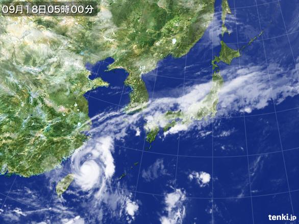
台風16号・マラカス、現在950ヘクトパスカル。
16th typhoon, Malakas is currently 960 hPs.
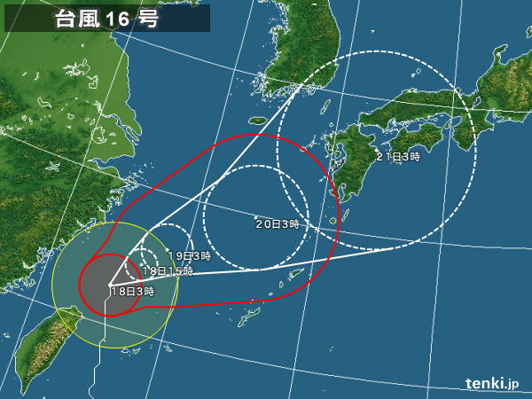
予想進路はこんな感じで、20日後半には西九州に上陸予報。
It’ll move like this and lands to West Kyushu on the 20th.
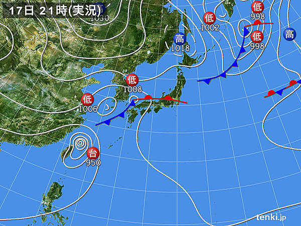
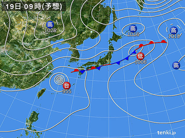
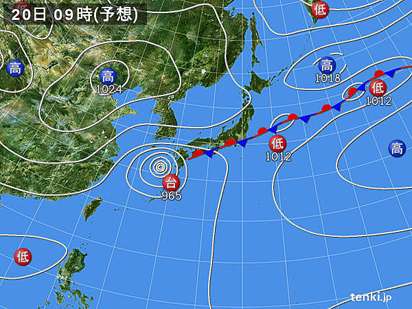
3日後までの予想天気図です。
西日本から東日本に横たわる秋雨前線に沿って、台風は日本列島を串刺しにしていきそう〜
当然前線の活動は活発化し、大雨は必至、風も南よりがブ〜ブ〜になるので、期待薄かにゃ?
Weather forecast of the next 3 days.
Typhoon is going to go past through Japan along rainy clouds~~
Weather’s gonna be heavy rain and wind should be southerly so not much hope for this one.
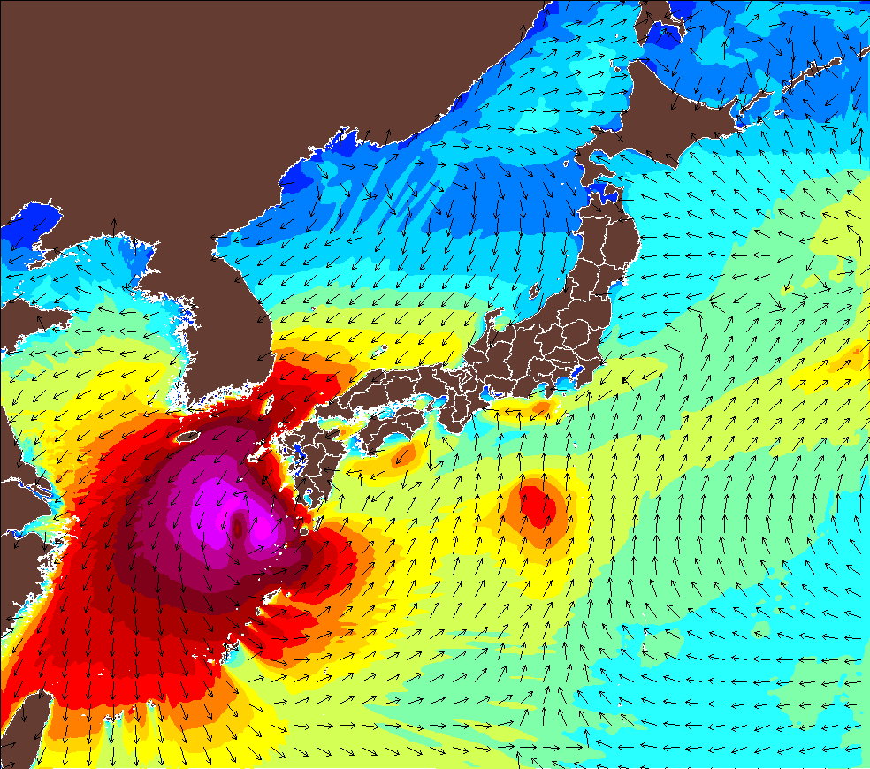
波伝説・ウエイブハンターによる、9月20日朝の波高予報。
九州西面は真っ赤か〜
くれぐれも台風による、大雨洪水土砂災害にはお気をつけください。
Wave Hunter’s wave forecast of September 20th.
Kyushu is all red~~
Be careful of the natural disaster is may come.